North Shore Peak-Bagging Part One: Brunswick Mountain
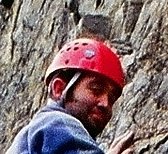
One of my goals for this summer is to climb as many of the Vancouver North Shore moutains as possible. Dave and I set our sights high when we chose Mount Brunswich for the first of our climbs. It's the highest of the North Shore peaks at 1785 meters. I checked with an old VOC friend for some data on the climb and he urged that we use ice axes and crampons in our ascent for safety's sake. I got Dave kitted out with axe, crampons and helmet at Mountain Equipment Co-op (my new employers - more to come on this) and we were set. I was eager to try out the axe and crampons I got from my Brother last Christmas.
On Sunday the 22nd of this month, Dave called me in the morning and picked me up shortly thereafter. We spent a few minutes picking up food for the climb before we headed to the small hamlet of Lion's Bay on the Sea-to-Sky Highway. Here we parked at the trailhead (we were the only car there), and began our climb up the switchbacks to our designated turn-off. It was completely fogged in and the mist blew through the trees and across our path as we continued. After about half an hour (just enough time to work up a bit of a sweat), we turned left at the fork. And headed down an old logging road towards Mount Brunswick. Unfortunately Dave's point-and-shoot was out of batteries and I had forgot my camera.
We shortly came to Magnesia Creek with a beautiful waterfall and I kicked myself for not bringing the camera. We forded the Creek and began a very long and very steep climb up deteriorating loggging road switchbacks. We reached the snowpack just below 1000 meters in elevation and struggled up to where the road ended and the Brunswick trail began at 1050 meters.
We imediately lost the trail (as we were following footprints) and began to bushwack a path straight up through the trees and steeply sloping snowpack. Very quickly we realised that we could go no further without our crampons and ice axes. We took a few minutes to put them on and then our progress picked up great speed. We fought through the trees and picked our way up the snowy slopes with relative ease but it was slow-going and very physically demanding. Some of the slopes were exposed and open amongst the trees, the steepness, Dave and I guessed, to be about 60 degrees in places. We climbed and had a great time until we looked at our watches and realized we'd never make the summit in time.
We finished our climb at about 1400 meters vertical on the western ridge of the mountain just a couple hundred meters from the rocky headwall to the summit. We'd climbed just about 1200 meters vertical over about 8 1/2 kilometers. It had been a steep and long climb and we decided to come down.
We did have some spectacular views however. The fogged cleared at times and we had commanding views of Howe Sound to our right and a very snowy and corniced Mount Harvey to our left. Once again I kicked myself for not bringing my camera. Just a few moments to slow down and breathe in the freedom of the hills.
On our descent I slipped from my grip with the crampons and went careening down steep snow slopes (often towards a terrified Dave who would have to dive out of the way). Usually the trees stopped me (a little painful). These bumslides continued as we made our way down and rejoined the long lost trail.
We were exhausted by the time we got to the logging switchbacks and it took us another 3 1/2 hours just to descend back to the car. The sun was out however and we had some beautiful views that remind me of why I live in this city and province.
Well, we failed to summit our first peak, but no matter we've resolved to come back in the summer months and do it sans snow and ice. It was a great time though and learning the tricks of axe and crampons was hard work but great fun.
Until later...
posted by Cory Sine @ 12:29 PM
0 comments
![]()

0 Comments:
Post a Comment
<< Home